Contacts
Reviews
Add a rating and review
Working time
- Sun-
- Mon830-1230, 1330-1730
- Tue830-1230, 1330-1730
- Wed830-1230, 1330-1730
- Thu830-1230, 1330-1730
- Fri830-1230, 1330-1730
- Sat-
Business data
- EUR 228768 / 2024
- 12
- Service provider
Legal data
- 41503026248
- LV41503026248
- 13.11.2000
- Liepu iela 9 – 19, Preiļi, Preiļu nov., LV-5301
- 2024
- 5
Description
Keywords
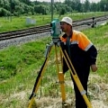
Land surveying and topography, Surveying, surveying works, surveyor, surveyors, surveying companies, surveying in Preili, surveying services, surveyor services, surveying in Latgale, topography, topography works, topographic research, topographic plan topographic plan drafting, topographical plans, topographical survey, geodesy, geodesist, geodesic works, geodesy, services, cartography, cartographer, photogrammetry, ground instrument surveying, land surveying, land surveying, cadastral survey, land cadastral surveying, land use, survey project, land use planning project, surveying, land boundary plans, border plan, border surveying, construction axis marking, construction axis, construction axis installation, building construction axis, building construction axis setting, building surveying, survey act, land boundary plan, inconsistencies act, delimitation, delimitation of the area, communications survey, lien plan, calculation of area, utilities setting, situation element surveying, quarrying, calculation of the volume, mineral resource volume calculation, volume gaugings, square gaugings, volume measurements, cost estimates, individual projects, area planning


